The maps featured here have been found while processing records, mostly court case files. Many were entered as evidence. We have many similar maps in the Archives and will upload more as time permits.
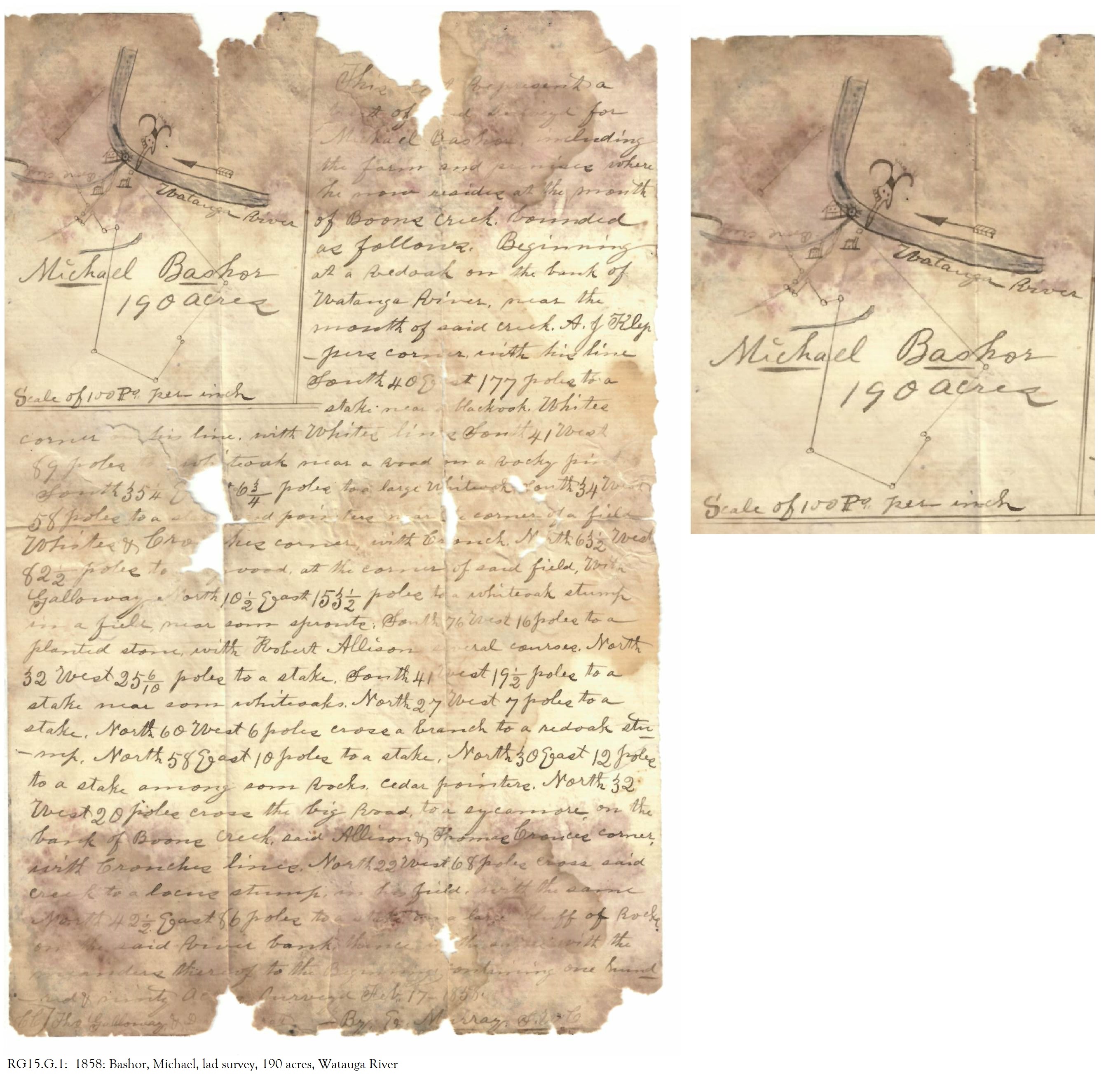
Bashor, Michael, land survey, 190 acres on the Watauga River 1858
William P. Smith property near the Nolichucky River and Conkling 1897

West Market Street, downtown Johnson City, 1895
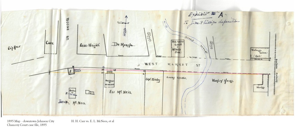
The two maps below depict the area of Boone Street and West Market Street in Johnson City. The hand-drawn map was evidence in the Chancery Court case file, Carr vs. McNees, 1895. Included is a modern-day map of the area. Notice the Watauga Saloon, a livery stable and blacksmith shop.

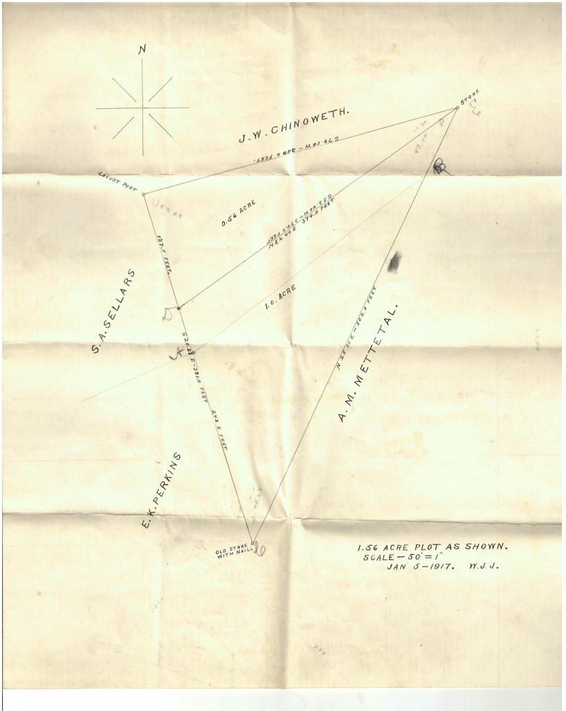
Properties of J. W. Chinoweth, S. A. Sellars, A. M. Mettetal, and E. K. Perkins 1916 Chancery Court case, 1916: John Chinoweth, et ux. vs. A. M. Mettetal.
Henderson Boothe property 1865
Chancery Court, 1865: George W. Telford and Henderson D. Booth vs. J. P. Boothe, et al.

Dillard Love property, on Brush Creek 1838
The above map was found in a Circuit Court case file from 1838: Dillard Love and wife, Margaret vs. the East Tennessee and Virginia Railroad Company.

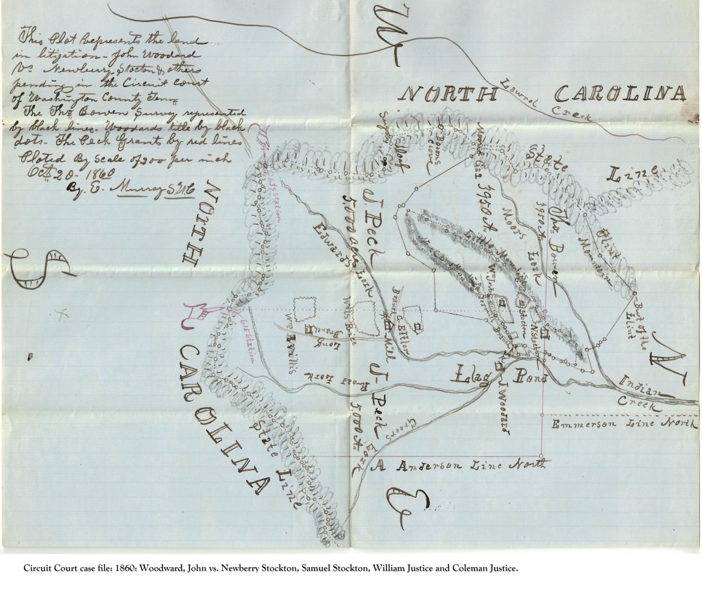
This map shows the Flag Pond area, now located in Unicoi County. Shown are the names, Peck, Edwards, Bowen, Anderson, Emerson, Ettler, Woodard and Stockton and “Jestes.” This map was in the Circuit Court case file: 1860: Woodward vs. Stockton and Justice.